Third and fourth graders spent time up close and personal with Vermont Maps.
They worked in teams and were challenged to look at any two of the
following map characteristics and then report out on what they noticed.
lines
numbers
colors
symbols
words "text"
It is amazing how much students learn about maps through an activity like this.
Check in with your child about what he or she learned about the Vermont map.
Team: Eddie and Eliot

Team: Sarah and Paige

Team: Thomas and Jack

Team: Jackson and Carter

Team: Naomi and Lily

Team: Julia and Nora

Team: Cady Scout and Jayden

Team: Ben, Alex, and Eli

Page and Sarah discovered that "numbers" and "letters"
can help you find locations on a map!

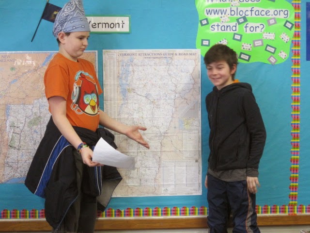
Jack and Thomas shared about "colors" and "lines" and
how a broken black line highlighted in yellow designates
roads that are closed in the winter.

Ben created a Venn "Ben" Diagram to show what Alex,
Eli, and Ben discovered about how "color" and "lines" intersect.

Eddie and Eliot share about "words" and how the size
of the font changes depending on the size of a city or
town. Larger towns have names printed in larger font.

Cady Scout and Jayden share that light green
lines outline counties.

Naomi and Lily that yellow designates what are urban areas.

Jack and Carter share several symbols and what the
symbols stand for.
No comments:
Post a Comment